Property Record
2565 Candler Rd, Decatur, GA 30032
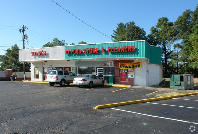
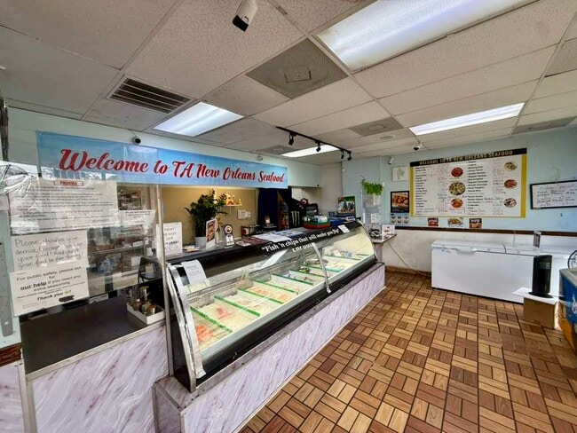

This Property Is For Sale
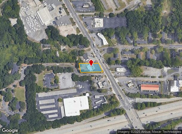
NEARBY LISTINGS FOR SALE OR LEASE
Property Detail
2565 Candler Rd
15-120-01-001
DeKalb
Storebuilding
Georgia
X
1
13089C0134J
0.60 AC
2025
Decatur/East Atl
2025
Atlanta
023603
Atlanta-Sandy Springs-Roswell, GA
3,101 SF
DEMOGRAPHICS near 2565 Candler Rd
1 Mile
3 Mile
5 Mile
2024 Total Population
10,502
82,275
231,248
2029 Population
10,723
82,551
232,047
Pop Growth 2024-2029
+ 2.10%
+ 0.34%
+ 0.35%
Average Age
40
40
40
2024 Total Households
4,241
32,480
92,046
HH Growth 2024-2029
+ 2.19%
+ 0.38%
+ 0.44%
Median Household Inc
$39,260
$54,069
$66,908
Avg Household Size
2.40
2.50
2.40
2024 Avg HH Vehicles
1.00
2.00
2.00
Median Home Value
$178,417
$244,752
$281,330
Median Year Built
1970
1971
1976
Nearby Places
- Restaurants
- Banks
- Shops
- Fitness
- Groceries
PUBLIC TRANSPORTATION
AIRPORT
Hartsfield - Jackson Atlanta International
DRIVE
WALK
Distance
Hartsfield - Jackson Atlanta International
21 min
12.7 mi
Freight Ports
Georgia Ports - Savannah
DRIVE
WALK
Distance
Georgia Ports - Savannah
274 min
244.5 mi
Nearby Properties
Address
Land Use
TOTAL SIZE
Lot Size
Zoning
Address
Land Use
TOTAL SIZE
Lot Size
Zoning
81,129 SF
4.29 AC
C1
Address
Land Use
TOTAL SIZE
Lot Size
Zoning
76,654 SF
3.14 AC
C-1
Address
Land Use
TOTAL SIZE
Lot Size
Zoning
105,624 SF
11.62 AC
MR-2
Address
Land Use
TOTAL SIZE
Lot Size
Zoning
91,622 SF
18.99 AC
X
Address
Land Use
TOTAL SIZE
Lot Size
Zoning
522,850 SF
41.34 AC
RM75
Address
Land Use
TOTAL SIZE
Lot Size
Zoning
278,121 SF
20 AC
RM85
Address
Land Use
TOTAL SIZE
Lot Size
Zoning
72,870 SF
12.34 AC
C2
Address
Land Use
TOTAL SIZE
Lot Size
Zoning
245,053 SF
22.77 AC
RM85
Address
Land Use
TOTAL SIZE
Lot Size
Zoning
158,939 SF
14.09 AC
RM85
Address
Land Use
TOTAL SIZE
Lot Size
Zoning
13,114 SF
17.54 AC
RM100
Address
Land Use
TOTAL SIZE
Lot Size
Zoning
295,632 SF
19.26 AC
RM75
Address
Land Use
TOTAL SIZE
Lot Size
Zoning
256,445 SF
11.71 AC
RM85
Address
Land Use
TOTAL SIZE
Lot Size
Zoning
40,809 SF
2.37 AC
C-1
Address
Land Use
TOTAL SIZE
Lot Size
Zoning
235,787 SF
15.43 AC
RM100
Address
Land Use
TOTAL SIZE
Lot Size
Zoning
59,246 SF
3.99 AC
X
Address
Land Use
TOTAL SIZE
Lot Size
Zoning
221,594 SF
15.90 AC
RM85
Address
Land Use
TOTAL SIZE
Lot Size
Zoning
554,853 SF
42.64 AC
RM75
Address
Land Use
TOTAL SIZE
Lot Size
Zoning
419,434 SF
21.59 AC
RM85
Address
Land Use
TOTAL SIZE
Lot Size
Zoning
219,652 SF
27.08 AC
C1
Address
Land Use
TOTAL SIZE
Lot Size
Zoning
132,604 SF
19.12 AC
RM100
Address
Land Use
TOTAL SIZE
Lot Size
Zoning
146,133 SF
16.10 AC
RM75
Address
Land Use
TOTAL SIZE
Lot Size
Zoning
367,452 SF
30.89 AC
RM100
Address
Land Use
TOTAL SIZE
Lot Size
Zoning
183,598 SF
18.88 AC
X
Address
Land Use
TOTAL SIZE
Lot Size
Zoning
217,904 SF
14.84 AC
Address
Land Use
TOTAL SIZE
Lot Size
Zoning
172,503 SF
15.39 AC
RM75
Address
Land Use
TOTAL SIZE
Lot Size
Zoning
207,757 SF
19.22 AC
RM85
Address
Land Use
TOTAL SIZE
Lot Size
Zoning
259,678 SF
14.20 AC
RM85
Address
Land Use
TOTAL SIZE
Lot Size
Zoning
118,310 SF
10.90 AC
RM85
Address
Land Use
TOTAL SIZE
Lot Size
Zoning
278,272 SF
21 AC
RM100
Address
Land Use
TOTAL SIZE
Lot Size
Zoning
256,096 SF
9.97 AC
RM-75
The World's #1 Commercial Real Estate Marketplace
Connect with us
© 2025 CoStar Group
The information above has been obtained from sources believed reliable. While we do not doubt its accuracy we have not verified it and make no guarantee, warranty or representation about it. It is your responsibility to independently confirm its accuracy and completeness. Any projections, opinions, assumptions, or estimates used are for example only and do not represent the current or future performance of the property. The value of this transaction to you depends on tax and other factors which should be evaluated by your tax, financial, and legal advisors. You and your advisors should conduct a careful, independent investigation of the property to determine to your satisfaction the suitability of the property for your needs.